blah blah blah
Mt. Shaw
Length: 8.8 miles out-and-backDifficulty (click for info): Hard
Elevation Gain: 1810 feet (+60 feet on return)
Rating (click for info): 7/10
Elevation: 2990'
Prominence: 2340'
Driving Directions:
Trailhead and parking area are on Ossipee Park Road in Moultonborough, NH. Ossipee Park Road starts on the northeast side of Rt. 171, 0.5 miles east of Rt. 109. Drive about 1.5 miles up Osipee Park Road. Parking is available at a small pull-off on the right with a kiosk just after the gate or along the road past Cones in the Clouds Ice Cream. Click here for a Google map.
About the Hike:
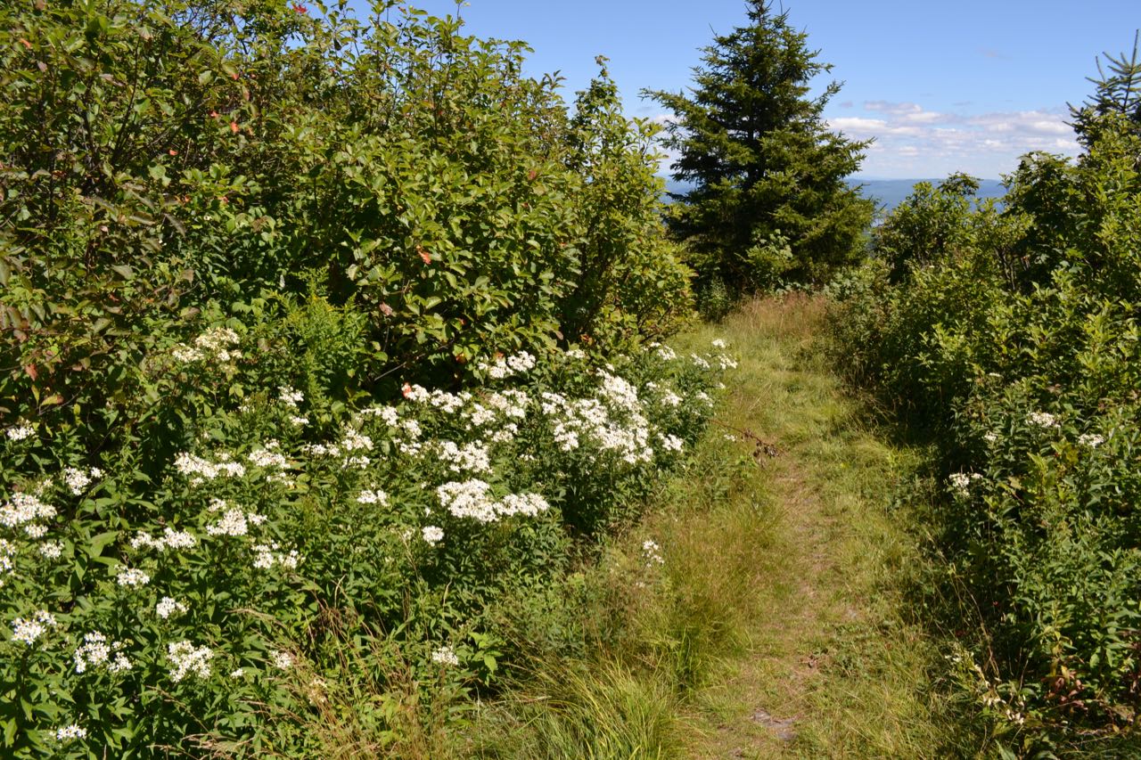
Mt. Shaw is the highest mountain in the Ossipee Range and the seventh most prominent mountain in all of New Hampshire. It is within the LRCT's Castle in the Clouds Conservation Area and can be reached through their extensive network of hiking trails built on old roads and carriage paths. Ironically, unlike the great number of lower mountains in the Ossipee Range with extensive open ledges, Mt. Shaw is entirely forested all the way to the summit. A clearing on the carriage road that leads to the summit is what provides it with a magnificent view of the White Mountains, as well as a place on the 52-With-a-View list. The same is the case with its south summit, known as Black Snout, which has open views to the south over the Lakes Region, complimenting the northerly view from the summit.
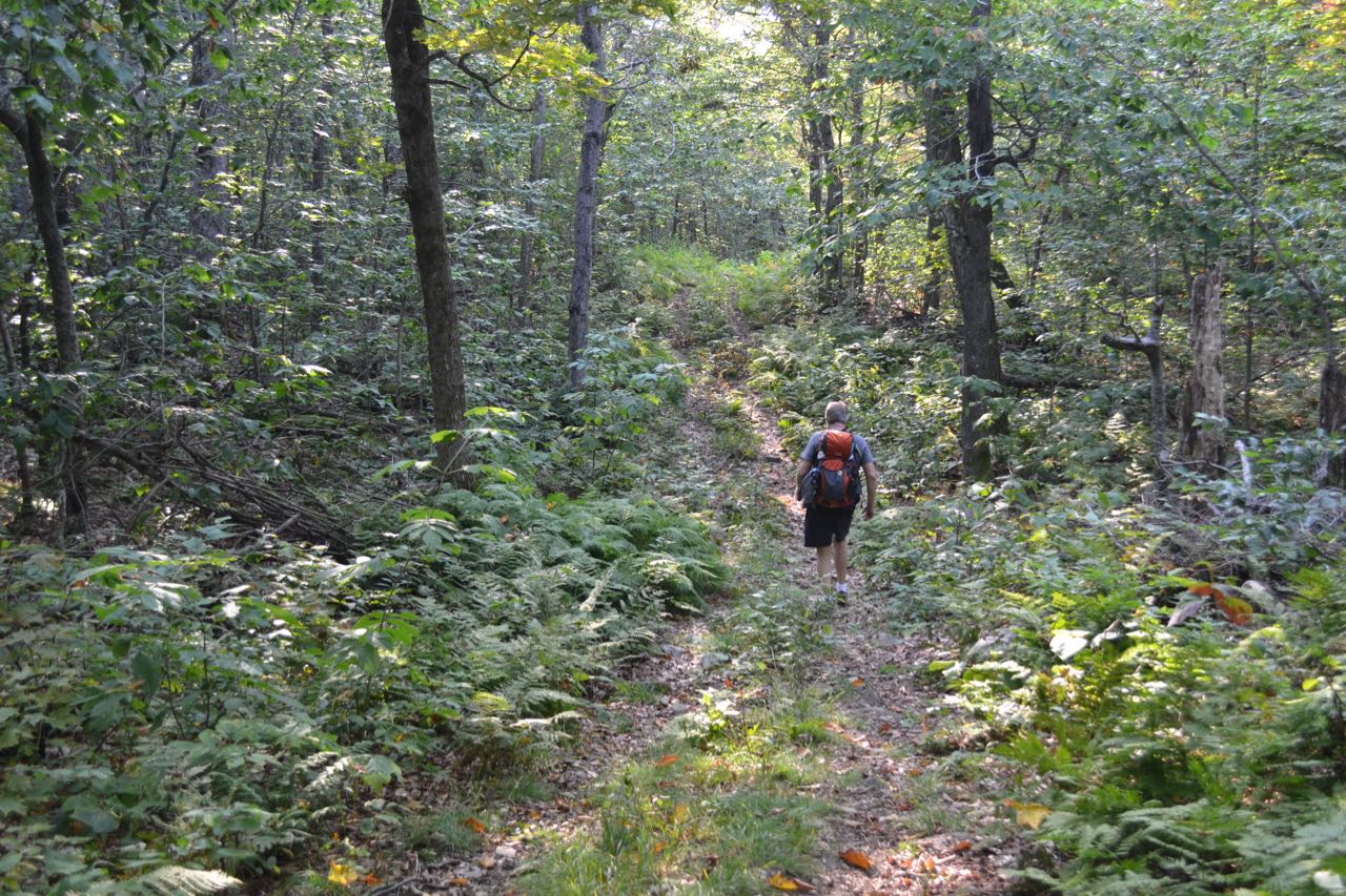
From the pull-off at the kiosk, walk down the road toward Shannon Pond and turn left onto the dirt road (Cold Spring Road). If you parked by the ice cream stand, just continue straight past the pond. Walk up the road, passing trailheads for Mt. Roberts Trail (left), Pond Trail (right), and Whitten Trail (left). In 0.5 miles, reach the trailheads for Settlement Trail on the left and Cold Spring Trail on the right. Turn right onto Cold Spring Trail, walk 0.1 miles, then turn right onto Faraway Mountain Connecter. Continue for a quarter mile as the trail crosses a small brook, swings uphill, and ends at Faraway Mountain Trail. Bear left, uphill, onto this trail, then bear right onto Oak Ridge Cutoff in 300 feet. This trail follows a rockier old road as it angles up the side of Oak Ridge. In half a mile, the trail reaches a junction with Upper Bridle Path on the right and crosses a small flat area at the top of the ridge. The road then becomes grassier and gentler and climbs easily for just under a half mile more to its end at High Ridge Trail. The High Ridge Trail is the main pathway following the ridge from Mt. Roberts to Mt. Shaw and uses a very gentle, winding old carriage road. Turn right and begin following it on its gradual course along the side of the ridge. In 0.1 miles, the old road makes a sharp left switchback, crosses a small plateau, and makes a winding descent to reach a junction with Turtleback Mountain Trail on the right in 0.4 miles, along with a wetland beside the trail. Continue straight on High Ridge Trail as it begins to ascend the summit cone of Mt. Shaw. It climbs moderately up a long straightaway, then makes a few wide bends and reaches an unmarked junction where a snowmobile trail merges in from the left in half a mile. Remember this spot for the descent; it is a confusing junction in the normally well-marked trail network. The old road then angles up the hillside, reaching a junction at the turn of a switchback in another 0.2 miles.
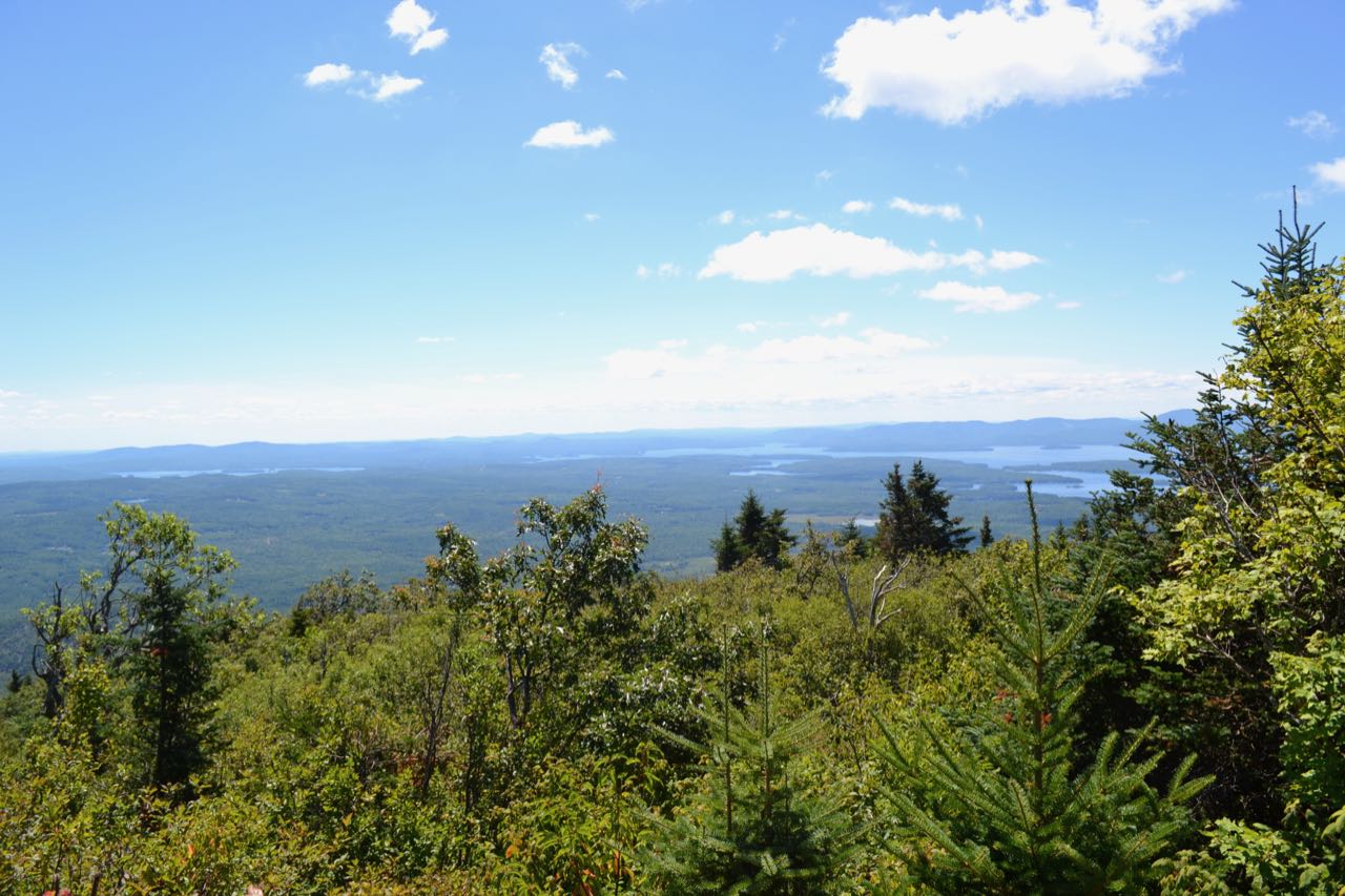
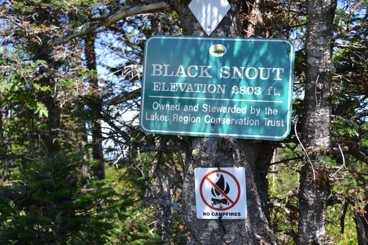
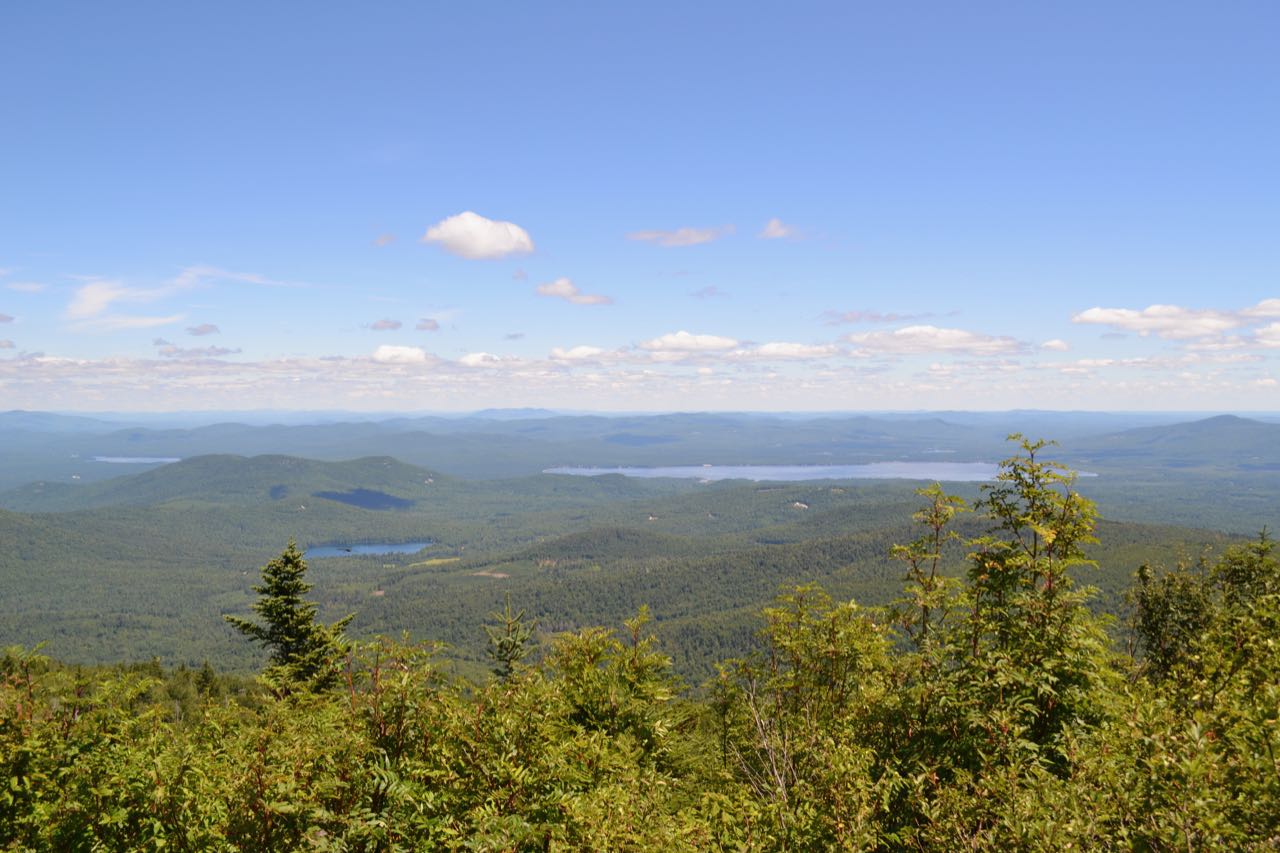
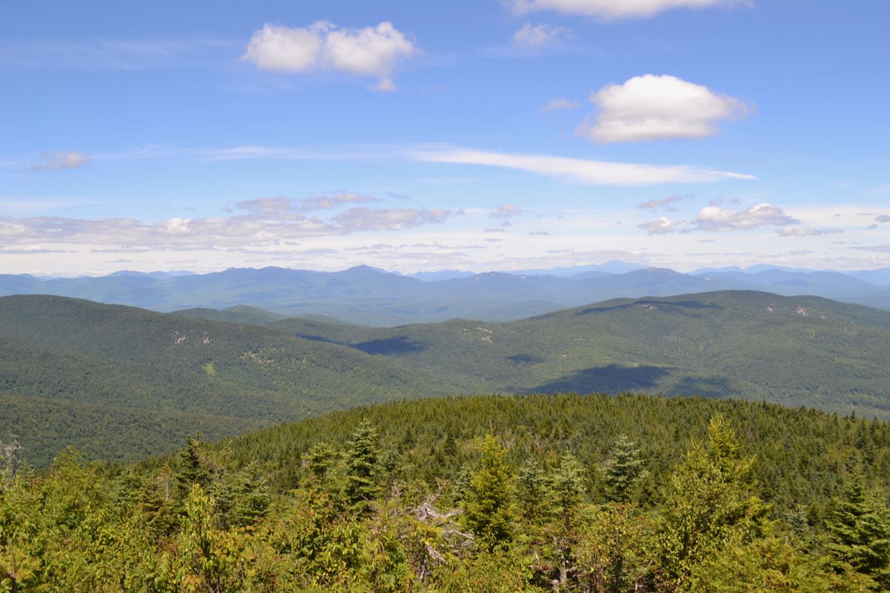
At this point, you can take a side trip to Black Snout, the south summit of Mt. Shaw. Turn right and follow the path for 0.3 miles as it runs nearly level across the hillside, then descends slightly to reach a junction with Black Snout Trail. Turn left and soon come out into an open area on the grassy road. Wind your way around to the south side and reach the summit in a quarter mile, where the road splits into a 150-foot loop around the highest point. From the summit, there are good views over the Lakes Region, although they are somewhat restricted by trees. The view takes in Lake Winnipesaukee and Squam Lake. The Belknap Range rises in the distance. The ledgy knoll of Turtleback Mountain is a prominent feature up close. You can also see the main summit of Mt. Shaw nearby. To continue to Mt. Shaw, backtrack all the way back to the High Ridge Trail. Bear right onto High Ridge Trail as the way you came into this junction the first time is on the left. The trail makes two long switchbacks, then ascends gradually to the summit in 0.4 miles. Just below the summit, the road splits into a 450-foot loop; as on Black Snout, the distance either way is equal. From the summit clearing, there is a wide directional view to the north, looking over the northern Ossipees to the White Mountains and to the northeast at Ossipee Lake. The Sandwich Range is seen well from this location. Mt. Moosilauke is seen to the left of Sandwich Dome. As the Sandwich Range crosses North and South Flat Mountain, Mt. Tecumseh, Mt. Osceola, and Mt. Lafayette are seen in the distance. Mt. Tripyramid is slightly obscured behind Mt. Whiteface. Mt. Carrigain appears behind and to the right of Mt. Passaconaway. Mt. Hancock is seen behind and to the left of Mt. Paugus. Between Mt. Paugus and Mt. Chocorua, the Presidential Range rises to Mt. Washington. The Carter Range appears to the right of Mt. Chocorua, with Carter Notch seen at an angle. Further over are the Baldface and Kearsarge North Ranges. Furthest over to the right, you overlook Ossipee Lake. Pleasant Mountain in Maine is a notable feature in the distance on the left side, while Green Mountain rises on the right, closer. There are two log benches at the trailside from which to enjoy the marvelous view.
Printable directions page